| |
from the geographic North Pole. A magnetic compass
points to magnetic north instead of true north because
of Earth's magnetic field. The amount the compass is
offset from the true pole is called variation.
Variation differs at various points on Earth's
surface, and at many points it increases or decreases by
a known annual rate.
Variation for any given locality, together with the
amount of increase or decrease, is shown on the compass
rose of the chart for that particular locality. On
small-scale charts of larger areas, however, variation is
shown by lines (isogonic lines) running through points
with the same amount of variation.
Along each line or every fifth line (depending upon
the type of chart used), variation is printed, and rates of
annual changes are shown between the lines.
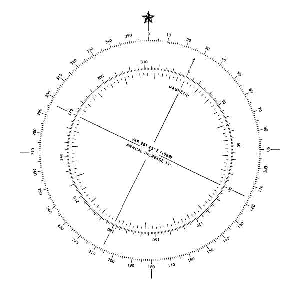
Figure 5-13 shows a compass rose indicating that in
1968 there was a 26°45' easterly variation in that area
and that it was increasing 11' annually. The total amount
of variation is found by multiplying the number of years
since the year printed in the compass rose by the rate of
annual change. The result is either added to or subtracted
from the variation given, depending upon whether the
error is increasing or decreasing. In this instance, total
variation in 1992 would be 24 years x 11' annual
increase + 26°45' = 31°09'.
Variation remains the same for any heading of a ship
or boat at any given locality. No matter which direction
your boat is heading, the magnetic compass, if affected
by variation alone, points in the direction of the
magnetic pole.
Deviation is caused by the magnetic metallic
masses in and on a ship. It is built into a ship and the
Figure 5-13.–Combination compass rose.
5-16
|

